
August 28th, Friday 8 in the morning, a group of around 25 rigs gather in Aurora, filled the tanks, and started the journey to O’Brien, OR, where we set up camp for the night to get ready for the adventure the following day was preparing for us at the McGrew trail.
We arrived around 5 p.m. to O’Brien, where the friends at the ‘O’Brien Country Store’ allowed us to spend the night in their backyard.
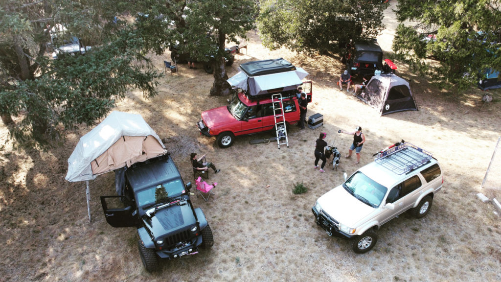
The place was perfect for our group to gather, have a meal, and get ready for the next day. Some people had roof tents, Scott brought his trailer, and some decided to go light and pack a tent. I was part of the latter group.
By 7 p.m., we were already cooking and sharing stories while examining each other’s rigs.
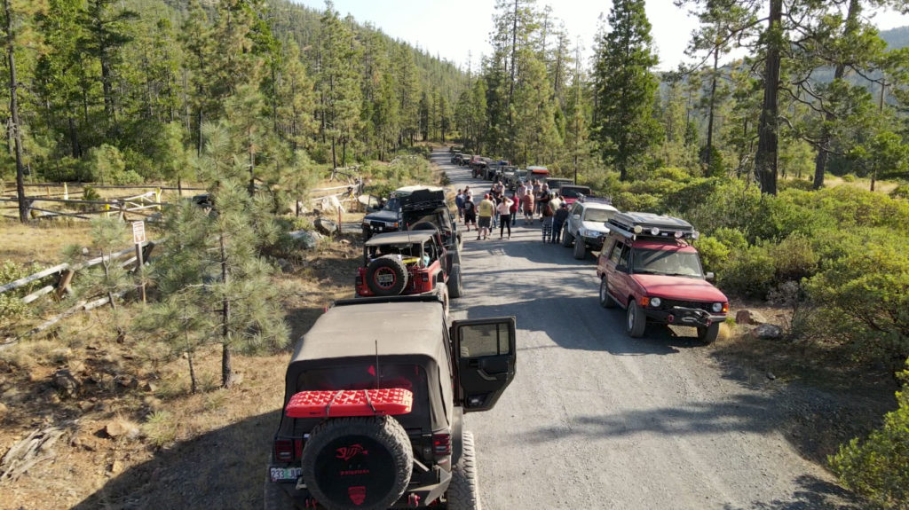
The following morning by 7 a.m., we were packing up and getting ready since the idea was to be at the entrance to the McGrew trail by 8:30.
The organizers decided to split the 25 rigs into three groups, the first one, with the most experienced people followed by another group. Finally, the last group that would also be learning recovery techniques while going through the trail.
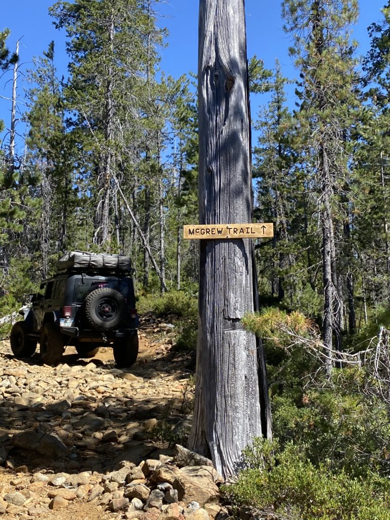
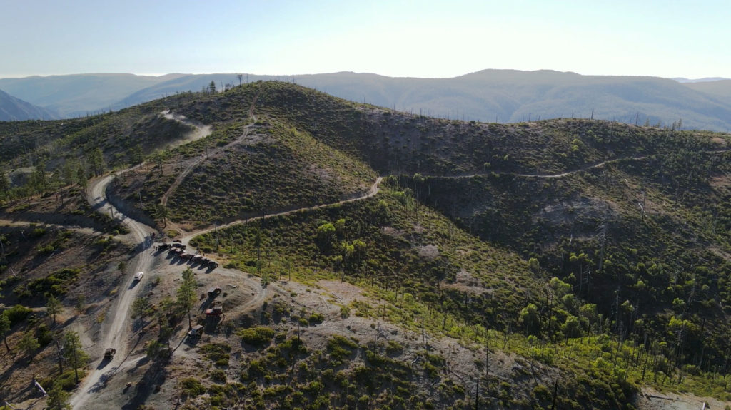
The first part of the trail is a bit more of rock crawling in some areas, going through what used to be the horse wagon road that connected California with Oregon hundred of years ago. As pointed by Gary, one of our guides, it is an exceptional privilege to be able to share a trail where you can see the marks on the rocks of hundred of wagons that passed over the years. Quite an experience.
It took us about 2 1/2 hours to complete the first part, where we stopped to have lunch for 40 minutes. After lunch, we continue to the second part of the trail, going through some of the forest saved from the fires 20 years ago. Later on, we arrived at the obstacle known as the little deuce and big deuce. The latter a large incline section that includes about a mile of pure rock fun challenges. Watch the video!.
Around 4 p.m., we finished and exited the trail. We all gathered at the exit overlooking the road we will soon be taking to go down to our camping destination following the NF-4402 route. The campground’s GPS coordinates were 42.0224531,-123.9675397.
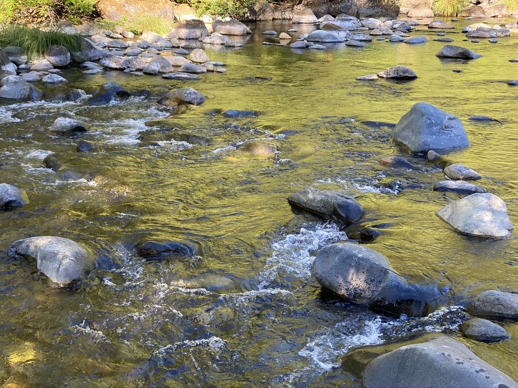
The campground, a rustic, pristine, peaceful area, surrounded by trees where a beautiful river goes through, had two primitive restrooms and enough spaces to accommodate everybody in the group a few yards from the water. The scenery was beautiful.
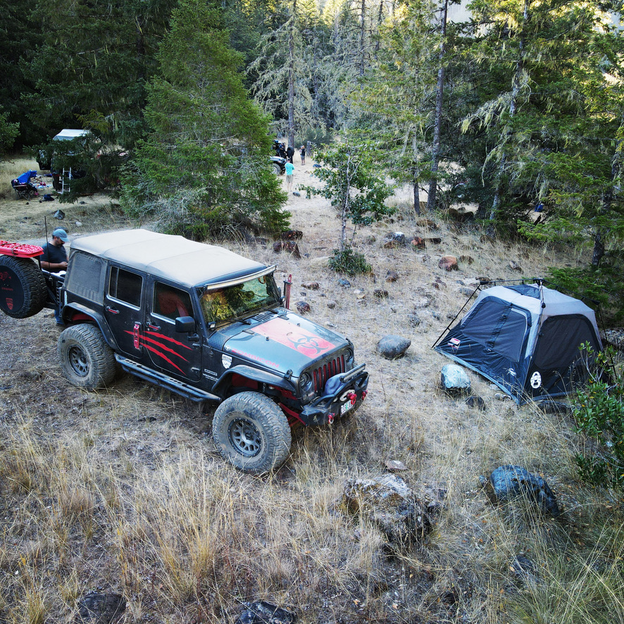
The perfect environment for us to spend the night, share more time with the Offroad Portal members, and enjoy Becca’s tacos, which by the way, were delicious. We had raffles for the participants, and for a few hours that night, we forgot we were still in the middle of the year 2020 and all it entails.
We are looking forward to organizing soon more of this kind of excursions with our group. It was a three days heck of an adventure.
Special thanks to all members who contributed images and videos of this adventure, making possible for us to share a more complete story for our readers.